This post outlines how to generate a KML file of a subset of POTA parks without leaving your browser. It’s important to remember the pota.app website is the official source of POTA park information. The information presented here is intended to help plan your outing. It’s up to you to ensure you are working with the most current data .
Why?
The pota.app is great. It takes care of 90% of the planning I need to do. But as I started to plan a 5+ park rove I immediately found a need to get the park locations out of the app for drive time estimates, and create multiple rove scenarios. KML will also make it easier to make the data available for offline use.
The Big Asterisk
This method is a bit hacky but it works. The release of the public POTA API could make my instructions unnecessary soon. Until then; we’re all hams here so let’s use the tools we have to solve the problem.
I used Chrome for my screenshots due to it’s popularity. The steps will be slightly different but similar in Firefox or Edge.
Step-by-step Instructions
TL;DR Video
Convert POTA points to KML quick & dirty videoGet the data from pota.app
-
Go to pota.app map pota.app/#/map
-
Open your browsers dev tools
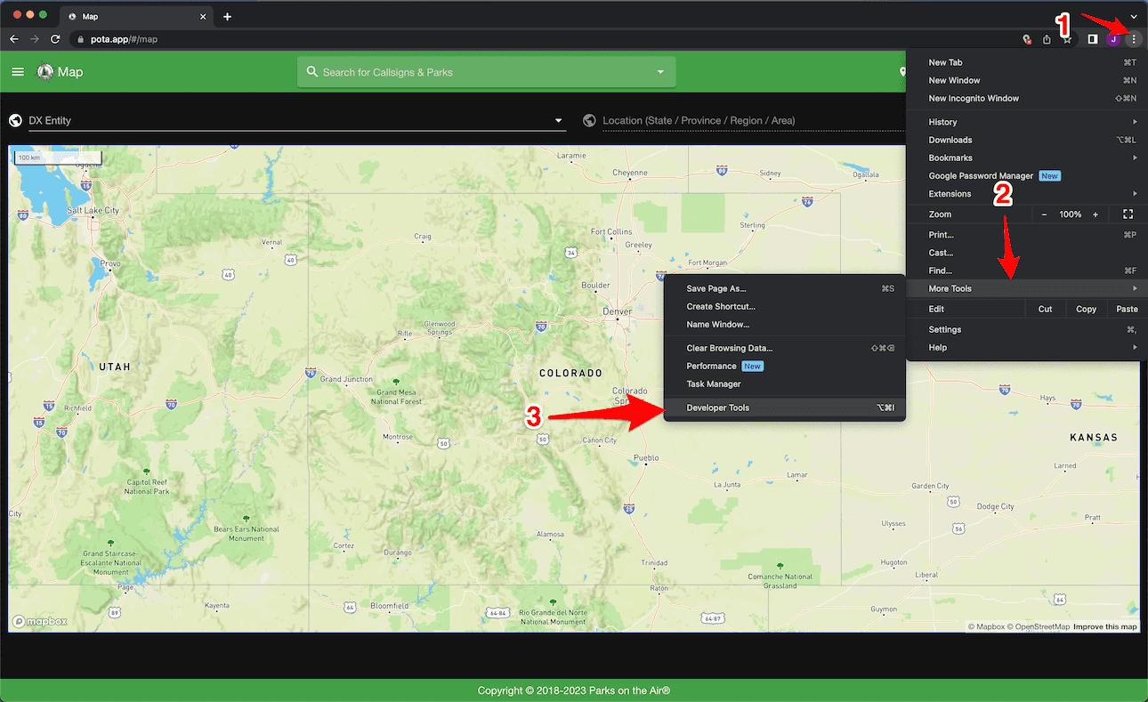
- Go to network tab
- filter requests to api.pota.app
- Limit responses to ‘Fetch/XHR’
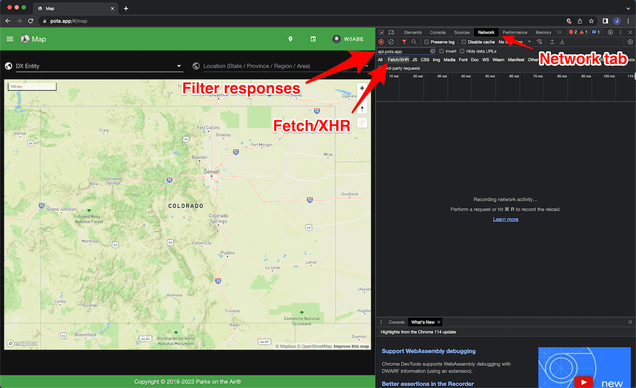
- Pan to the map extent you want and zoom until the points representing parks are visible
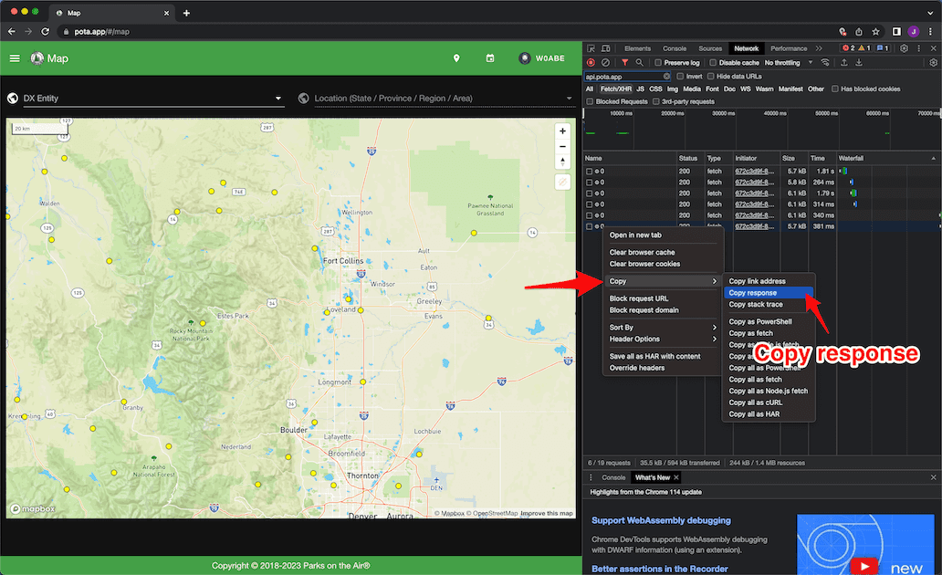
- the dev tools right click on the last request in the list and choose ‘Copy’ —> ‘Copy Response’
Convert Your Clipboard to KMZ
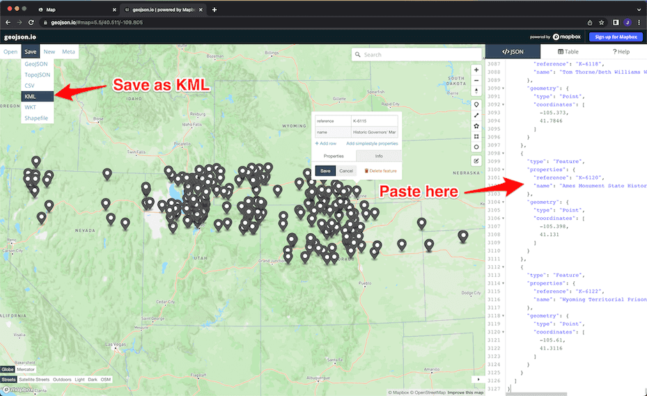
- Visit geojson.io
- Remove all the JSON in the panel on the right
- Paste the JSON response we copied from dev tools
- You should see the points. on the map and can click the points to see the park names
- In the top left chose Save—> KML to save the points as a file
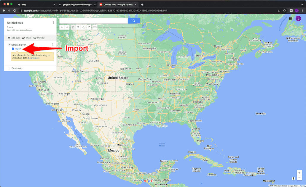
Google MyMaps
- Visit google.com/mymaps
- Create a new map
- Import your KML
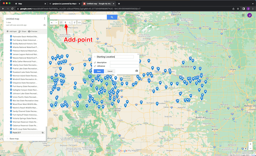
- Click and drag points to edit locations as needed
For some parks the point represents the general location of the park and does not necessarily represent an entrance or parking lot. If you need to move points to locations where you will active a park you can click on the map marker once to select and then click and drag to move. Make sure you review all points you would like to participate in driving directions to ensure accurate results.
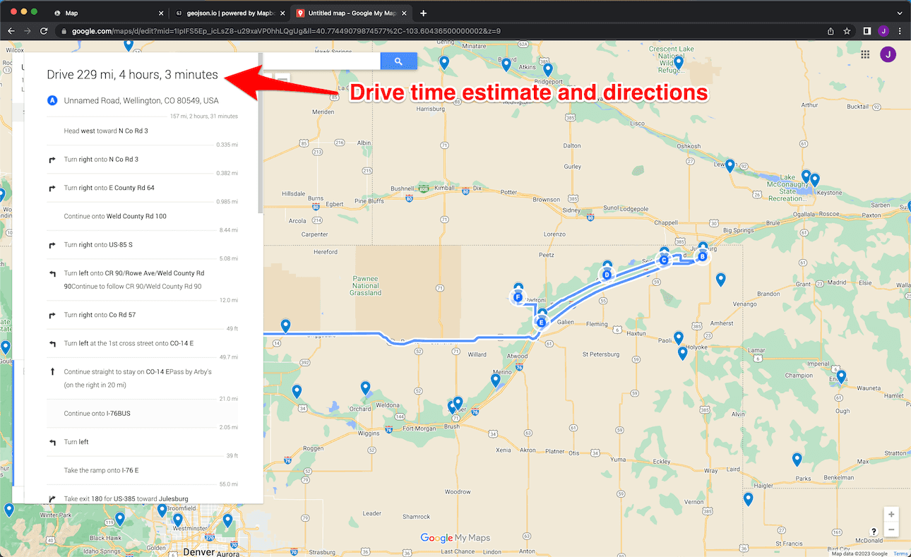
Directions and Drive Times
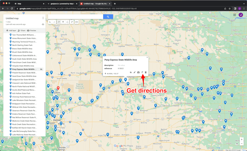
- Add your starting location
- Choose a park and get directions
 3. Add additional parks
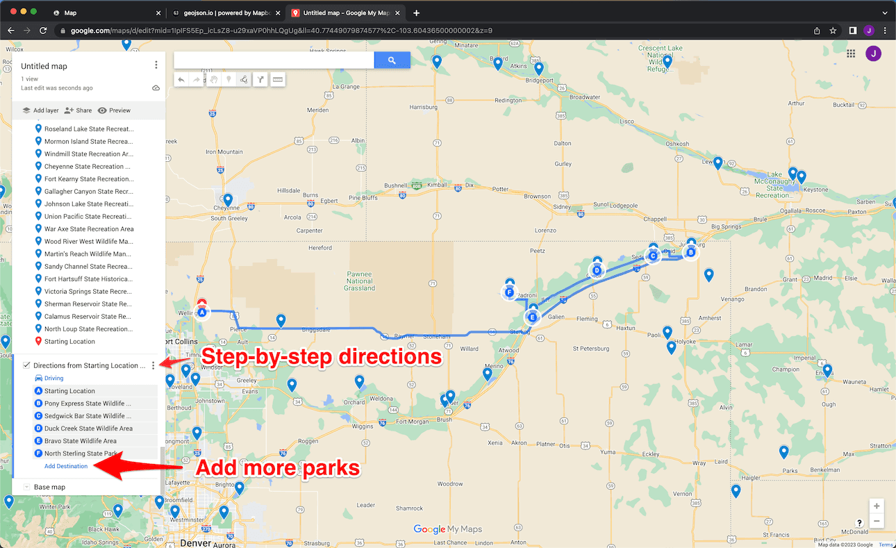
- Step-by-step directions
- Drive time estimates
MyMaps allows you to create multiple driving direction layers. Use the check box to control visibility. This feature allows you to build out a number of rove scenarios.
Offline Maps
Avenza Maps allows you to find and create maps that work without internet access. You can import your KMZ directly into Avenza Maps.
The USFS provides 7.5 min quads and Motor Vehicle Use Maps (MVUM) for free through the Avenza Store. I recommend MVUM maps if they are available for the area you are interested in. MVUM maps show just the necessary information and are simple to read and understand.
Good Luck!
Thats it. If there is a better way please let me know. Otherwise, happy roving and I hope you found this helpful.
73 WØABE